

|
|
The Kathmandu Valley rim offers excellent opportunities for hiking and mountain biking. Taxis and buses are available to get to the starting point of the trail. Good bikes can be rented at many shops around town. Here are some routes in the north, east, south and west of Kathmandu:SHIVAPURI
Hiking. The climb to the top of Shivapuri hill (altitude 2,732 m), which lies directly to the north of Kathmandu, takes about three hours. The path is alternating level walks through forests and steep inclines. The summit of Shivapuri is one of the four pilgrimage peaks on the valley rim. The trail begins behind the shrine of Budhanilkantha (9 km, bus or taxi). For the return, you can walk along the ridge that descends south to Bouddha where transport is available.
SANKHU-NAGARKOT
Hiking. Head east from the ancient village of Sankhu (16 km to the east of Kathmandu, bus or taxi) passing terraced fields and farm houses to the Himalaya viewing spot of Nagarkot (12 km, three-four hours). This route is good for mountain biking too. Nagarkot is 2,175 m high. For the return to Kathmandu, you can take a different route by walking south to Banepa via Nala (four-five hours) and then catching a bus.
BHAKTAPUR-CHANGU NARAYAN
Hiking. Walking north from Bhaktapur (12 km to the east of Kathmandu, bus or taxi), turn left at the road leading to Nagarkot to reach the hill-top shrine of Changu Narayan (4 km, two hours). The walk offers panoramic views of the mountains, terraced fields and the Manohara river. There is also a small village on the eastern side of the temple. You can avoid the same route getting back to Kathmandu by climbing down the northern slope to the road where you can catch a bus.
BHAKTAPUR-BANEPA
Biking. Bhaktapur (12 km to the east of Kathmandu) to Banepa (14 km from Bhaktapur), a historical town on the way to Tibet, is terrific for mountain biking. If you want to avoid trucks, there is an old road from Bhaktapur to Banepa that goes via Tathal and Nala. From Banepa, you can take a side-trip south to Panauti (7 km) or east to Dhulikhel (6 km). An interesting circuit is Banepa to Dhulikhel (6 km) to Namura (7 km) to Panauti (8 km) to Banepa (7 km).
KATHMANDU-KODARI
Biking. The 114-km highway linking Kathmandu with Kodari on the Chinese border follows the ancient trade route to Lhasa. Known as the Arniko Highway, this spectacular road leads east past Bhaktapur, Banepa, Dhulikhel and Dolalghat and then turns north following the course of the Sun Koshi and Bhote Koshi rivers. Picturesque villages and tranquil terraced fields against a backdrop of green hills are the scenic rewards on the trail. The trip takes four days up and down. Overnight at Dhulikhel or Barhabise (88 km from Kathmandu) and Tatopani (3 km before Kodari) where the hot springs are an added attraction.
PHULCHOKI
Hiking. Phulchoki (altitude 2,762 m) to the southeast of Kathmandu is the highest of the four pilgrimage peaks ringing the valley. The top offers views of the Himalaya to the north and the Terai plains to the south. A Hindu shrine sits amidst a tangle of TV and radio antenna towers. There is an abandoned iron mine about three-fourths of the way up. Its forested slopes are covered with rhododendrons and orchids. The trail (about three hours to the top) begins behind St. Xavier’s School at Godavari (20 km from Kathmandu, bus or taxi). There is also a dirt road up the mountain.
CHAMPA DEVI
Hiking. Champa Devi hill (altitude 2,247 m, also known as Dhinacho) is situated to the southwest of Kathmandu. A popular way up is from Haatiban (9 km, bus or taxi) on the road to Dakshinkali. The trail takes two-three hours and begins next to the Haatiban Resort car park. The first stretch is a pleasant stroll through pine forests. The final approach is a very steep climb over rock outcroppings. There is a Hindu shrine and a Buddhist stupa on the summit. For the return, you can avoid using the same route by continuing west along the ridge, and climbing down the northern slope to Naikap on the highway to Thankot where you can catch a bus.
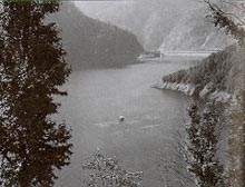
KATHMANDU-KULEKHANI
Hiking. Follow in the footsteps of the old travellers on this historic trade route. This walking trail was the only way from Kathmandu to India until the Tribhuvan Highway was built in 1956. Head south from the police checkpost at Thankot (10 km to the west of Kathmandu, bus or taxi), and climb over the valley rim at Chandragiri Pass (elevation 2,280 m) to the village of Chitlang and on to Markhu beside the Kulekhani reservoir (Lake Indrasarovar, five-six hours). Overnight at Markhu (basic lodges) and visit the Kulekhani dam (two hours). Return to Kathmandu by bus over the Tribhuvan Highway, or walk east to Pharping (four-five hours, the trail begins at Kalanki near the dam) where you can catch a bus to Kathmandu (18 km).
KATHMANDU-DAMAN
Biking. The 75-km stretch up to Daman on the Tribhuvan Highway has been described as the best bike ride in Nepal. Until the bypass through Mugling opened about two decades ago, this was the only road to India. The good news for bikers is that there is very little traffic on the highway now. The road spirals up and down endless hills and passes through broad valleys and small villages. Exit the Kathmandu Valley at Thankot (10 km from Kathmandu) and on to Naubise (25 km) where the road forks. Turn left to Tistung (59 km) and on to Palung (65 km) and finally Daman (altitude 2,400 m). There is a view tower here which offers an incredible 400-km panorama of the Himalaya extending from Annapurna to Everest. The bike ride to Daman takes all day. Lodges available.
NAGARJUN (JAMACHO)
Hiking. Nagarjun hill (altitude 2,096 m) is a popular pilgrimage site. The trail begins at the entrance of the protected forest (5 km to the northwest of Kathmandu on the way to Kakani from Balaju, bus or taxi). The walk to the top takes about two hours. Great views of the Kathmandu Valley and a number of Himalayan peaks can be had from here. There is a Buddhist stupa and a view tower on the summit. A dirt road (37 km) also winds up the hillside.
BALAJU-KAKANI
Biking. The route to Kakani (altitude 1,982 m) branches off at Balaju Bypass (3 km to the northwest of Kathmandu central). It is a slow and easy ascent to this hill resort 23 km northwest of Kathmandu. The trip offers a magnificent view of Ganesh Himal along with the fresh and serene atmosphere of the hills. There are a number of restaurants on the way.
MD Publishing Co.
Pvt. Ltd.,
Tripureswor, P. O. Box 3525, Kathmandu, Nepal.
Tel: 260327, 256003 . Telex: 2611 EMC NP. Fax: 977-1-261159.
E-mail:nttj@mos.com.np
Design and Maintained by Amaa Network Consultant, Inc.
Last Updated: 24 July, 2000
Comments and Suggestions to: Webmaster